
Block Name: The Grateful Table
The Grateful Table Cafe & Provisions
473 Main Street, Canton, NC 28716

Block Name: Beznoska
Andon-Reid Inn
92 Daisy Ave, Waynesville, NC 28786

Block Name: Grooming Block
Maple Tree Veterinary Hospital
1855 Russ Ave #5828, Waynesville, NC 28786

Block Name: Boarding Block
Maple Tree Veterinary Hospital
1855 Russ Ave #5828, Waynesville, NC 28786

Block Name: Shelton House Block
The Shelton House
149 Shelton Street Waynesville, NC
GPS: N35º 29.29.152’, W082º 59.18’

Block Name: Mountain Saddlebags
Shook Museum
178 Morgan Street, Clyde, NC
GPS: N35º 31.8982’, W082º 55.1351’

Block Name: Little Red Schoolhouse
Haywood Institute
3 Brown Street, Clyde, NC
GPS: N35º 31.8796’, W082º 54.6799’

Block Name: Little Red Schoolhouse
Maggie Valley Town Hall
3987 Soco Road, Maggie Valley, NC
GPS: N35º 31.0327’, W083º 5.6703’

Block Name: Biloxi/Fox Chase
Boone Orchard Apple House
395 Hugh Massie Road, Waynesville, NC
GPS: N35º 28.2302’, W082º 57.3116’

Block Name: Bridge to Learning
Central Haywood High School
3215 Broad Street, Clyde, NC
GPS: N35º 32.0583’, W082º 54.7698’

Block Name: Life’s Path
The Homestead
127 Sunset Ridge Road, Clyde, NC
GPS: N35º 31.6108’, W082º 56.7432’
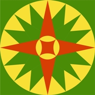
Block Name: Mariner’s Compass
Ketner House
3894 Soco Road, Maggie Valley, NC
GPS: N35º 30.9879’, W083º 5.1849’

Block Name: Grandmother’s Dream
Dawson Family Barn
200 Feather Lane, Waynesville, NC
GPS: N35º 29.7119’, W082º 53.7516’

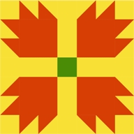
Block Name: Maple Leaf
Mountain Joy
121 Setzer Cover Road, Maggie Valley, NC
GPS: N35º 31.0895’, W083º 5.8585’
Block Name: Bear Paw
Smoky Falls Lodge
2550 Soco Road, Maggie Valley, NC
GPS: N35º 30.7702’, W083º 4.8454’

Block Name: Mr. Roosevelt’s Necktie
Stomp ‘N’ Ground
3116 Soco Road, Maggie Valley, NC
GPS: N35º 30.8209’, W083º 4.8454’

Block Name: Brush Arbor
Louisa Chapel
570 Main Street, Clyde, NC
GPS: N35º 31.6147’, W082º 54.7613’

Block Name: Open Door
Clyde’s First Bank
81 Main Street, Clyde, NC
GPS: N35º 32.0127’, W082º 54.6634’

Block Name: Little Birds
The Windover Inn
40 Old Hickory Street, Waynesville, NC
GPS: N35º 29.2101’, W083º 0.0611’
Block Name: Follow the Leader
Municipal Building
16 South Main Street, Waynesville, NC
GPS: N35º 29.3766’, W082º59.29’

Block Name: Dead Man in a Creek
Fines Creek Community Center
190 Fines Creek Road, Clyde, NC
GPS: N35º 40.9247’, W082º 57.2811’

Block Name: Stars & Stripes & City Streets
Waynesville Police Station
9 South Main Street, Waynesville, NC
GPS: N35º 29.3695’, W082º 59.2685’
Block Name: New Star of North Carolina
The Corner Building on Main
20 Church Street, Waynesville, NC
GPS: N35º 29.3937′, W082º 59.3014’

Block Name: Cobblestones
Teresa Pennington Art Gallery
15 North Main Street, Waynesville, NC
GPS: N35º 29.3974’, W082º 59.2843’

Block Name: Star of North Carolina
Mast General Store
63 North Main Street, Waynesville, NC
GPS: N35º 29.4425’, W082º 59.2873’
Block Name: Red, White, and Blue
Mast General Store
63 North Main Street, Waynesville, NC
GPS: N35º 29.4425’, W082º 59.2873’

Block Name: Christmas Story Book
113 North Main Street, Waynesville, NC
GPS: N35º 29.473’, W082º 59.2424’

Block Name: Gillespie Rifle
Michael D. Gillespie, DDA, PA
611 South Haywood Street, Waynesville, NC
GPS: N35º 29.2872’, W082º 59.4318

Block Name: Mile High Fun
Cataloochee Ranch
119 Ranch Drive, Maggie Valley, NC
GPS: N35.549451, W-83.092519

Block Name: Lone Star
Cataloochee Ranch
119 Ranch Drive, Maggie Valley, NC
GPS: N35.549451, W-83.092519

Block Name: Winding Walk
Haywood County TDA
I-40 West Welcome Center, Mile Marker 10
Block Name: Travel Star
Canton Museum
36 Park Street Canton,NC
GPS: N35.532843, W-82.83950600000003

Block Name: Pigeon Valley
Bethel Rural Community Organization
664 Sonoma Road, Waynesville, NC
GPS: N35.473091, W-82.895454

Block Name: Sunburst
Exclusive Interiors and Decor
70 Main Street, Canton, NC
GPS: N35.535382, W-82.836952

Block Name: Snail Trail
Ponderosa Quilt Retreat
184 Park Drive, Waynesville, NC
GPS: N35.486744, W-82.97724

Block Name: Moon Over Cold Mountain
Cruso Community Friendship Club
13186 Cruso Road, Canton, NC
GPS: N35.419071, W-82.812507
Block Name: Liberty Star
Clyde Town Hall
8437 Carolina Blvd, Clyde, NC
GPS: N35.532553, W-82.911486

Block Name: Flower Petals
Howell Farm; Lillian Howell Rumsey
126 Cicero Lane,Waynesville, NC
GPS: N35.565815, W-83.018583

Block Name: Dahlia
Elements Salon
140 Broadview Road,Waynesville, NC
GPS: N35.4964298, W-82.9755726

Block Name: Double Wedding Ring
Haywood Lodge
257 Shelton Street, Waynesville, NC
GPS: N35.482971, W-82.987385

Block Name: Five Spot
Champion Credit Union
1 Academy Street, Canton NC
GPS: N35.533376, W-82.838591

Block Name: Flower Basket
Polly’s Florist
53 Main Street, Canton, NC
GPS: N35.489135, W-82.988348

Block Name: North Carolina Lily
Haywood Community College
185 Freedlander Drive, 1900 Building, Clyde, NC
GPS: N35.525357, W-82.928087

Block Name: Bayleaf
Southern Porch @ The Imperial
117 Main Street, Canton NC
GPS: N35.535382, W-82.836952
Block Name: A Salute to the Colors
Canton Armory
71 Penland Street, Canton, NC
GPS: N35º 5261494’, W-82.8421123’

Block Name: Leadership
Town Square
79 Depot Street, Clyde, NC
GPS: N35º 32.0165’, W82º 54.3881’

Block Name: Conversations
Clyde Masonic Lodge
69 Main Street, Clyde, NC
GPS: N35º 533737, W82.910817’

Block Name: Adopt Me
Animal Hospital of Waynesville
91 Depot Street Waynesville, NC
GPS: N35.492491,W-82.988343

BLOCK NAME: Gateway to the Smokies (Spring)
Joey’s Pancake House
4309 Soco Rd. Maggie Valley,NC
GPS: N35º 314.163’, W83º 6’1.707″

BLOCK NAME: Mountain Traditions
Pavilion @ Camp Hope
312 Camp Hope Road Canton, NC
GPS: N35.3873195′, W-82.8133229

BLOCK NAME: Still Farming
Elevated Mountain Distilling
3732 Soco Road, Maggie Valley, NC
GPS: N35º 51.8232’, W-083º 090703’

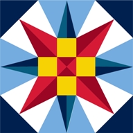
BLOCK NAME: Star
Cabbage Rose Gift Shop
3388 Soco Road, Maggie Valley, NC
GPS: N35º 51.5638, W-83º.084757’

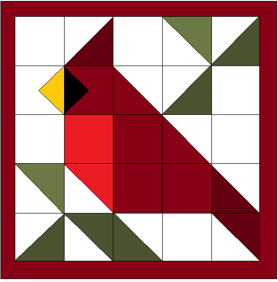
BLOCK NAME: Cardinal
The Cardinal Inn
3735 Soco Road, Maggie Valley, NC
GPS: N35º 51.7141’, W083º 090504’

BLOCK NAME: Tree of Learning
Haywood County Library – Waynesville Branch
678 S. Haywood Street Waynesville, NC
GPS: N40º 44.30.822’, W073º 21508’

BLOCK NAME:
Haywood Regional Medical Center
262 Leroy George Drive Clyde, NC
GPS: N40º 42.345991’, W074º 21502’

BLOCK NAME: Happy Memories
Skyland Camp for Girls
30 Bunny Ct. Clyde, NC
GPS: N35º 32.29.702’, W085º 29275’

BLOCK NAME: Fall Leaves
Mr. Smith’s Residence
262 Sweet Birch Drive Maggie Valley, NC
GPS: N35º 31 42.737’, W083º 2’58.324’

BLOCK NAME: Dogwood Blossom
Private Residence
290 Dogwood Drive Maggie Valley, NC

BLOCK NAME: Point on Point
Private Residence
1641 Frank Davis Road Waynesville, NC
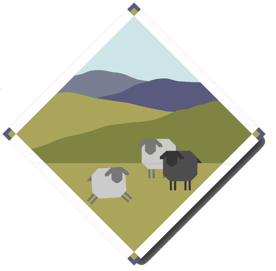
BLOCK NAME: Mountain Sheep
Private Residence
103 Flowing Brook Lane Waynesville, NC

BLOCK NAME: Festive Fall Baby Quilt
Private Residence
29 Mary Gray Drive Clyde, NC

BLOCK NAME: Cherokee Star
Folkmoot
112 Virginia Avenue Waynesville, NC

BLOCK NAME: Crane
Folkmoot
112 Virginia Avenue Waynesville, NC

BLOCK NAME: Blue Globe
Folkmoot
112 Virginia Avenue Waynesville, NC

BLOCK NAME: Red & Blue Star
Private Residence
178 Sandridge Way Waynesville, NC
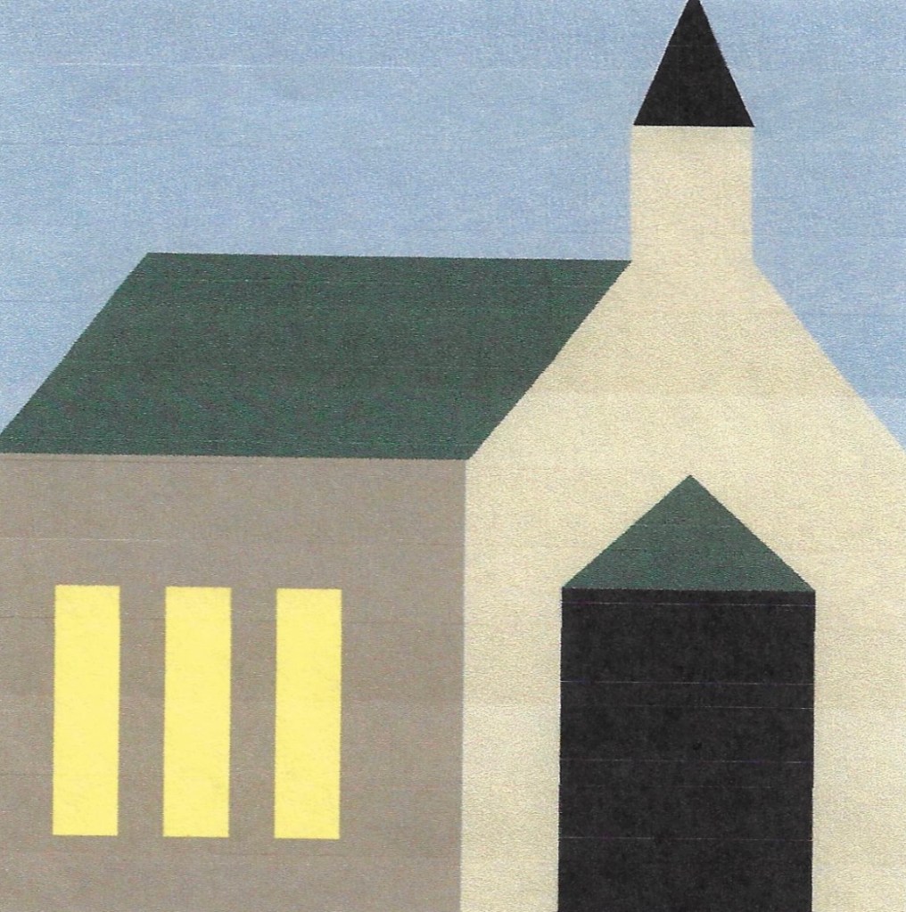
BLOCK NAME: Fines Creek Methodist Church
Fines Creek Methodist Church
1590 Fines Creek Road Clyde, NC

BLOCK NAME: Harmony, Community, Inclusiveness, Life
Pigeon Community Multicultural Center
450 Pigeon Street Waynesville, NC

BLOCK NAME: Blue Ridge Sunshine
Private Residence
299 Cansadie Top Road Waynesville, NC

BLOCK NAME: Key Lime Pie
Private Residence
79 Crestmont Drive Waynesville, NC

BLOCK NAME: Sunflower
Private Residence
161 Chipwood Lane Waynesville, NC
BLOCK NAME: Carolina Lily
Private Residence
2062 Iron Duff Road Waynesville, NC

BLOCK NAME: Scallywags
Scallywag’s Consignment Furniture
171 Muse Business Park Waynesville, NC

BLOCK NAME: Dogwood
Historic Cabin
142 Marquis Lane Waynesville, NC

BLOCK NAME: Mountain Cabin with Tree
Private Residence
101 Jefferson Lane Waynesville, NC

BLOCK NAME: Paw
Maple Tree Vet
255 Russ Ave Waynesville, NC

BLOCK NAME: Sweet Faces
Maple Tree Vet
255 Russ Ave Waynesville, NC

BLOCK NAME: Digital Marketing Quilt of Many Colors
WNC Social Media Buzz
50 S. Main Street Waynesville, NC

BLOCK NAME: Mountain Vista
Private Residence
331 Everview Lane Waynesville, NC
BLOCK NAME:
Private Residence
118 Maple Street Waynesville, NC

BLOCK NAME: Traveler’s Companion
Private Residence
1113 Wood Farm Road Maggie Valley, NC

BLOCK NAME: Apple Tree
Private Residence
555 Massie Road Waynesville, NC

BLOCK NAME: Mountain Mama Bear
Private Residence
250 Shelton Street Waynesville, NC
BLOCK NAME: Carolina Cardinal
Private Residence
256 Poplar Drive Clyde, NC

BLOCK NAME: Cold Mountain Quilt
Cold Mountain Art Collective
33 Adams St Canton, NC
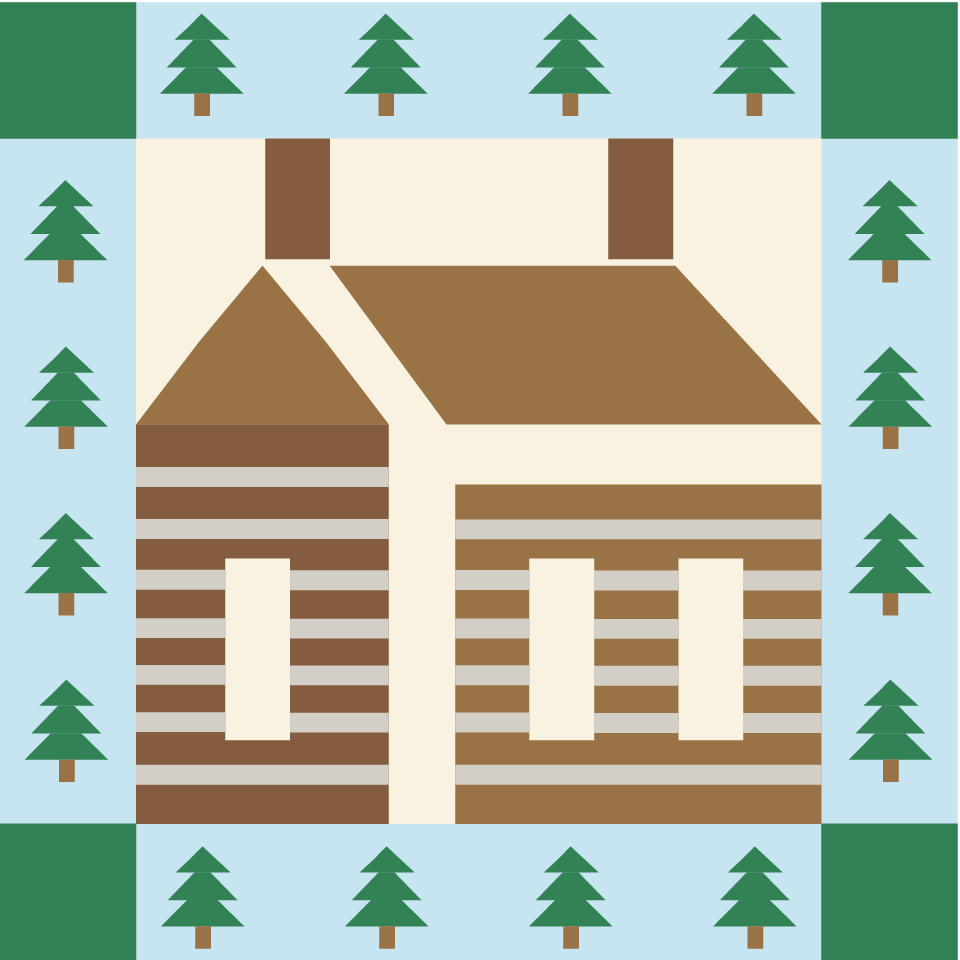
BLOCK NAME: Log Cabin
Boyd Mountain Log Cabins
445 Boyd Farm Road Waynesville, NC

BLOCK NAME: Elk
A Little Creek Cottage
146 Little Creek Lane Maggie Valley, NC

BLOCK NAME: Son Rise
Organic Beans Coffee Company
3680 Soco Road Maggie Valley, NC

BLOCK NAME: Buffalo Creek
Buffalo Creek Vacations
13 Caboose Way Clyde, NC

BLOCK NAME: Flaming Anvil
Ken Hall Knives
606 Stevenson Cove Road Waynesville, NC

BLOCK NAME: Blue Mountain Realty
Blue Mountain Realty
478 Frank Mehaffey Road Maggie Valley, NC

BLOCK NAME: Inspire
Haywood County Public Library – Canton Branch
11 Pennsylvania Avenue Canton, NC

BLOCK NAME: Mountain Bloom
Private Residence
1564 Country Club Drive Unit 201B Maggie Valley, NC

BLOCK NAME: The Tale of Tails
Behavior Tails
422 Valley View Drive Clyde, NC

BLOCK NAME: Three Bears
Three Bears Cabin
155 Mull Cove Road Maggie Valley, NC

BLOCK NAME:
Private Residence
702 Jonathan Creek Road Waynesville, NC

BLOCK NAME: Carolina Birds
Private Residence
154 Tamaraack Trail Waynesville, NC

BLOCK NAME: Peace
Pigeon River Mercantile
365 Main Street Canton, NC
BLOCK NAME: Spools
Private Residence
44 Silverbell Lane, Waynesville, NC
